Wednesday, 26 July 2017

In memory of those that perished on the ss Waratah.


On the morning of the 27th of July 1909 at 6.00 am local time 108 years ago on the east coast of South Africa, two ships signalled a total of 32 words between them. The Clan Macintyre called up the passenger ship the ss Waratah by signal lamp and exchanged pleasantries, after the exchange the Waratah pulled ahead of the Clan Macintyre and was last seen on the horizon at about 9.30 am and simply disappeared creating one of the greatest sea mysteries of the century. The Waratah was the new flagship of the Blue Anchor Line of London and was on her second voyage from England to Australia and home again with 211 souls that perished with her.


                                                                       SS WARATAH.


                                           SS CLAN MACINTYRE 2  at Capetown on a different voyage. 

The officer that initiated the the first signal between the two ships was the fourth mate of the Clan Macintyre Mr.W. E. Carson aged 19 years who flashed, what ship? to the Waratah. According to the chief officer Mr. George Phillips who had the watch from 4.00 am to 8.00 am said the signalling lasted about half an hour. The crew of the Clan Macintyre amounted to a total of  69   persons, mostly Lascars with white officers in control.

                                                                  THE WHITE CREW. 

Master Captain A. Weir,
Chief Officer G. P. Phillips
2nd Officer W. Crichton, 
3rd Officer W. Cothmander,
4th Officer W.E. Carson, 
Midshipman S.P. Lamont,
Midshipman D. Shaw, 
Chief Engineer P.Jackson, 
2nd Engineer  J. Sweeny, 
3rd Engineer E. Potts,
4th Engineer D.Shaw, 
Steward J. MacKenzie. 
Please note Mr. Rider who was the 2nd officer of the Clan Macintyre on the voyage before but had paid off, gave an interview to the press at Hobart in March 1910 when he was then a passenger aboard the ss Ionic on his way to New Zealand  describing the the events of the present voyage mentioned above. He was obviously describing events that must have been related to him  by a fellow officer when the Clan Macintyre  docked on arrival back in the U.K. The above crew list was taken from actual records of the time in question and is correct.

                                     Let us not forget those lost aboard the Waratah 108 years ago.

                                                                 The Ocean
                                               
                                                 The ocean has its silent caves,
                                                 Deep, quiet and alone;
                                                 Though there be fury on the waves,  
                                                 Beneath them there is none
                                                 The awful spirits of the deep
                                                 Hold their communion there;
                                                And there are those for whom we weep, 
                                                The young,the bright and fair. 
                                                Calmly the wearied seamen rest
                                                Beneath their own blue sea.
                                                The ocean solitudes are blest,
                                                For there is purity.                                                 
                                                The Earth has guilt, the Earth has care,
                                                Unquiet are its graves;                                               
                                                But peaceful sleep is ever there,
                                                Beneath the dark blue waves. Nathaniel Hawthorne.


Tuesday, 4 July 2017

July 3rd 1909 Waratah arrives at Adelaide.


108 years ago on the 3rd of July 1909 the Waratah arrived at Adelaide for a four day stop over before leaving at 4.30 pm on the 7th of July for Durban  and Capetown on her homeward voyage to London. Adelaide pilot Mr. I. John McDiarmid joined the Waratah two miles south of the Port Adelaide Lighthouse and piloted her up the River Torrens to  Ocean Steamers Wharf, her draught taken at the berth prior to loading cargo was 25 feet 8 inches forward and 26 feet 4 inches aft.


                                        Port Adelaide Light House on Neptune Island in 1909.


                                             Waratah berthed at Ocean Steamers Wharf Adelaide.


               Ocean Steamers Wharf Looking south, ship across river is at Birkenhead Wharf.

In 1907 the chart datum or depths at Ocean Steamers Wharf showed an average depth of 25 feet 6 inches for the full length of the berths along this wharf.  The actual chart showed in the notes that High water Full and Change at 5 hours 10 minutes, rising to 8.5 feet at springs and 5 feet at neaps. The High water Full and Change simply means, the FULL refers to the time of FULL MOON and the Change to the time of a NEW or changing MOON, (every two weeks).   The Waratah touched bottom at low tide in very soft mud because her draught was over 25 feet and  increased as she loaded more cargo, much has been made of this by bloggers who obviously do not understand ship construction and bleat about her bottom plates being made of brittle steel and her rivets breaking under stress because they had a high sulphur content, no known evidence, scientific or otherwise has been put forward regarding the Waratah by these bloggers. If this was the case Barclay and Curle the ship builders would have soon been out of business for using defective materials. Bloggers point out the Titanic with her brittle plates partly due to below freezing temperatures of the North Atlantic waters, combined with weak rivets which in certain hull plates were found to be defective, they immediately  assume this could be the case with the Waratah. The Waratah  cannot be compared with the Titanic, both ships were vastly different in size and built specifically for two different trade routes.When the Waratah touched the muddy bottom she did so in a gentle manner with the fall of the tide as opposed to a sudden drop like a brick which could of course be likely to spring rivets, if this had been the case quick soundings of the double bottom tanks would soon show any ingress of water, obviously the hull remained intact, otherwise Captain Ilbery would not have sailed if there was any serious damage,  he would have also put in a notice of protest to the British Consul at Adelaide. One blog posted reads,  Captain Ilbery stated on arrival at Durban that the Waratah had sustained no damage since departing Adelaide but the wording did not include damage sustained at Adelaide. The writer is implying that there was damage but can give no proof of it which infers that Captain Ilbery was lying in his signed declaration. The Waratah was by no means the only ship to sit on the mud at low tide many ships were subject to the same plight yet none seemed to suffer any ill effects, there was difficulty for some wanting to leave their berths and had to wait for the right tide, one White Star Line ship waited for thirty hours. Captain Ilbery expressed his concern about his ship to the Marine Board and also to the shipping agent about the state of the river bottom at the berths and the strains that could be put on a ships framing. Another concern he had about being on the mud was that of his chief engineer Mr. George Hodder who was worried about the cooling water for the main condenser, cooling water is taken in from the sea by two suction intakes in the ships hull, only one at a time is used. One suction or intake is right on the bottom of the hull and the other is just below the waterline on the side of the hull. These two intakes are called sea chests and are protected by grills to stop any foreign matter being sucked in and blocking the pumps. The biggest worry of course is the sucking up of mud and sand silt into the pump, I suspect that Mr. Hodder would have used the higher up intake on the side of the hull while in the river.


                                                  Upper sea chest intake on ships side.

The problem of the conditions in the river resulted from a lack of dredging as there was only one dredger in use and this was working at the new outer harbour berths to accommodate very large passenger liners. This was a continual operation to keep the depths at the river entrance and the berths at 32 feet deep, therefore the dredger could not be spared for the river. Ships master and their companies were not happy about their ship using the Ocean Steamers Wharf but faced with the option of loading and discharging cargo into lighters and having coal brought out to them, the cost factor won over because they saved 10 shillings on  a ton on coal and six shillings on a ton of cargo by not using lighters at the outer anchorage, there was also the factor of the time effect and delay in turn around times in order to keep voyage schedules.


                                         A new suction dredger arrives in Adelaide in 1911.

The Waratah was moved to the Outer Wharf where she took in the remainder of her cargo prior to departure. It is said without proof, that the Waratah was over loaded but that is certainly not the case according to official evidence. For example, the stevedore foreman makes mention of the fact the harbour master checked the Waratah and her draught marks to ensure she did not over load as he did with all ships in his port. Captain J.H Gibbon who was the Lloyd's surveyor for Adelaide and warden of the South Australian Marine Board was given the draught marks and calculated the freeboard of the Waratah in salt water at 10 feet 3 inches and made mention of the fact that she was 2 feet 2 inches lighter than her Lloyd's marks, in one of her upper tween decks she had additional cargo space for a further 150 tons or more   ( so much for being over loaded.)


                        Captain J.H Gibbon, he also had Port Gibbon in South Australia named after him.


Friday, 30 June 2017


On the 23rd of June I posted some close up photographs of the ss Waratah with one photo of the port side showing no Plimsoll markings or load lines. I made mention of the fact but in doing so did not mean to imply the markings were never painted on the ships side in the first place, the markings were compulsory by law and if there were none painted on the ship she would have been prevented from sailing from London. The photograph is of poor quality and combined with  lighting conditions does not show enough detail of the hull, by enhancing the photograph to a high magnification I have managed see part of what was the plimsoll mark. The reason for the indistinct marking is due to the paint being worn off in rough seas and high winds, salt crystals have a very high abrasive effect and act as a liquid form of surface blasting.


The white circle shows the part of the plimsoll marks directly under the out board discharge which would also assist in the paint fading.


                             Rust can also help for poor identification on badly maintained ships

         
                                                         Statue of Samuel Plimsoll in Bristol. 

.


Sunday, 25 June 2017

Some interesting pictures from my collection.


For those readers interested in the Blue Anchor Line ships I have put up one or two photographs for them to enjoy as it is always wonderful to see pieces of history as it really was so long ago.


The photograph shows Captain Pentin and his lovely wife Jessie Marion Pentin aged 24 years aboard the ss  Wilcannia in Sydney in September 1895. Mrs Pentin was on the crew list as Stewardess. The offficer on the left seated by the hatch is Mr .R Bidwell  chief officer as indicated by one stripe on his right shoulder, the captain having two gold stripes. Mr. Bidwell went on to become the marine superintendent for the company and later commanded the Narrung. The group photo is taken in front of the poop deck house which was richly furnished with a saloon and cabins for twelve passengers. Looking at the lifeboat on the poop deck above to the right of the picture, you will notice two round dots on  the bow. These are in fact wooden plaques with circumferences being adorned with carved ropes and the house flag of a blue anchor in the center. The Titanic lifeboats had similar plaques on her boats with the white star in the center. In the event of any wrecked life boats being washed up on a beach with the name missing the plaques would give a clue as to what ship they came from.

                           The Wilcannia in an unknown dry dock which displays her sleek hull lines.


               A very rare close up photo of the Wooloomooloo witht the Bungaree astern of her.
         Today the 25th of June is the day the Waratah sailed from Sydney on her Fateful voyage.


Thursday, 22 June 2017

A closer look at the Waratah not previously seen.


This well known photograph of the Waratah is used by just  about every blogger that has written articles on the ship, it was taken on or about the 5th of July 1909 prior to her moving to the Adelaide outer berth to top up cargo before sailing on the 7th of July for Durban. In this photo we see almost all of her starboard side, while at this berth another photo was taken from across the river showing her port side in full length.

                                                                                                                                    
                                                                       Port side view of  Waratah.

Please note while there is no known copy write on these two pictures of the ship, I have created  separate enhanced views which are newly created photographs and therefore hold copy write to these new photographs which are my own creation.
The object of my exercise is to try and bring to life parts of the Waratah and persons contained therein in order to give the reader a more practical view of the ship and bring it to life as she was in 1909. 
                                                                 VIEWS OF THE PORT SIDE.

                  Two crewman  painting the funnel, note paint pot hanging from the man on the right.


Red square shows a crewman at a fresh water header tank on the boat deck , probably topping it up from the shore supply. These tanks were gravity fed to the temporary built wash closets   down below on deck for use by tween deck immigrant passengers and were only turned on for a short period in the mornings. 
Yellow square shows four glass ports in boiler room skylight, the skylight is opened fully to catch a breeze to help cool the air below. 
Blue square shows a casual observer leaning on the rail taking in the sights across the river.
Note no Plimsoll markings on side of ship in midships section at the waterline, free board was determined by manual measurement, an exercise which I have carried out on many occasions when conducting surveys.


Red circle shows the crane man on hatch number 1 with his left arm in the air, he directs the man driving the winch by signals to lower or raise the cargo either going in or out of the hold .
White rectangle shows the faint outline of the name Waratah, the light is against the camera.
Blue arrow shows the ship has ample draft at the waterline at this stage.
Yellow rings show water ballast being discharged.


                                                                           Aft Section.
Red square shows either crew members or stevedores taking a break and possibly fishing.
Yellow arrow shows a boat, (Cutter), used as a service boat when at anchor or, lowered rapidly in case of a man overboard, there are no chocks and the boat only needs to be swung out.  
                                 
                               VIEWS OF THE STARBOARD SIDE OF WARATAH.


Are there any living relatives that may recognize  these two crew members on the bow. I have managed to match them up to a group photo of the crew shown below.


                      The officer circled with a blue ring is the chief engineer Mr. George Hodder.


The black arrow indicates the steam  windlass for dropping anchors weighing anchors.
The orange oval is the ships bell on the fore deck  used by the officer in charge of anchoring. The ship is equipped with 3 bells, the bridge bell for ringing out the watches and the crows nest bell for the lookout to alert the bridge of any dangers ahead.  It is rung to inform the bridge how much chain is let out or taken in and is struck when 15 fathoms of chain or one shackle  90 feet passes out marked by white paint which is easy to see in the dark.
The black rectangle shows crutches for the ships derricks to lay in and lashed down when at sea.


The black oval circle shows the halyard lines which are used when the ship is at anchor and a black shape or ball is hoisted to show she is at anchor in daylight hours.
The blue square highlights the Blue Anchor Line flag flown from the jack staff. 


 The orange circle shows the fore mast white light.
The black arrow shows the end of the 20 ton lift derrick which was stowed vertically against the fore mast at sea.
The black circle shows the retaining collar that secured the derrick to the mast. It was this derrick that the boatswain threatened to leave the ship at Adelaide with other seamen if it was not laid down. He said "we don't need all that extra weight high up in the air." This indicated that the sailors knew how tender the ship really was and were frightened of her.


The yellow rings show two seamen working on the funnel.
The blue rectangle shows the compass binnacle on the monkey platform, the cover is taken off for navigating officers to take bearings by compass and also to check compass error by the sun.
The red circle shows a short man overlooking cargo operations, possibly Captain Ilbery who was a very short and walked with a limp.


The yellow outline shows a quartermaster on gangway duty facing the camera with an officer at the head of the gangway with his back to the camera.
The white rectangle shows a coal loading door open by which coal is is loaded into a chute or scuttle. These doors have to be re caulked or sealed and made secure prior to sailing. 
The red square indicates two ladies returning to the ship possibly the two stewardess Emma Swan and Sarah E Whitehorn after a visit ashore.


                             The crows nest with the red circle showing the warning bell.


T

Tuesday, 20 June 2017

A close up of the ss Waratah the fore deck.


.

 
Copy write Capt. Stan Robinson.
Are there any living relatives that can identify the well dressed man facing the camera, if so, could you contact me or  email Suzanne Patterson on (sapatt17@gmail.com).
 
 
In this photograph we are able to determine that the ship has wet decks and the cargo derricks are not rigged with wire cables. This would indicate that the vessel has been made secure for sea and is about to sail for a lengthy leg of the voyage, or the photo was taken when the Waratah was deep sea.
                                                               
                                                                 COLOURED SYMBOLS.
No1. Black oval circle is the bridge bell.
No2. Green square is the builders brass plate.
No3. Purple arrow shows an escape ladder in case of fire from the upper decks down, it was this ladder that was broken off on the lower deck by heavy seas.
No4. White circle shows a deck light on the lower cross tree with a streak of rust.
No5. Blue stars show canvas winch covers.
No6. Yellow arrow pointing to number 1 hatch coaming.
No7. Red rectangle shows a screw down mushroom vent above the deck equipment locker, and paint store.  
 
Your help in this matter would be appreciated, Stanley Robinson.


Friday, 17 February 2017


                     A FRESH LOOK AT AN ALLEDGED SHIP ON FIRE AND THE ss HARLOW.
So much has been written about the ss Harlow and what Captain Bruce of the Harlow saw and  claimed that there was a ship on fire right astern of him, this vessel was supposed to be coming up fast behind his own ship, this vessel then  allegedly blew up and was immediately lost from view. At the time Captain Bruce had no idea as to  which ship it was if indeed there was a ship on fire, it turns out that at a later date he thought it may have been the ss Waratah the Blue Anchor Line passenger ship that went missing  after leaving Durban bound for Capetown. 
 
                                                      Waratah at Capetown on her maiden voyage 1908.


On the 26th of July 1909 on her second voyage as a new ship, Waratah departed from Durban harbour at 8.15 pm on her homeward run to England and was due to call in at Capetown  some 830 nautical miles from Durban but disappeared along the way never to be seen again. Before proceeding with the Harlow account I should  like to point out to the reader that while newspaper reports of the  time carried the stories involving the Waratah, there was a great deal of truth in them but at the same time there was a lot of misreporting especially when positions in terms of latitude and longitude were seriously incorrect. For the reader to understand fully they should study the following map which highlights quite clearly a  case of careless reporting in the press.
 
 
In the above map we see the correct position of the Waratah indicated by a yellow pin at 6.00am on the morning of the 27th when in latitude 31degrees 36minutes south longitude 29 degrees 58 minutes east where she was last seen and spoken to by the cargo ship the Clan Macintyre. Above that we see another yellow pin indicating an incorrect position of the Waratah given  by a newspaper report. This position is given in the paper as, latitude 29 degrees 17minutes south longitude 29 degrees 17 minutes east, this bears no relation to the correct position. In fact it shows the Waratah as being 122 miles inland from the nearest part of the coastline and 143.5 miles away from the correct position in a slightly N Westerly direction.
In the Annex to the Court Report Preliminary observations, section V11 headed Theories of the Vessel's loss  it reads as follows;
One suggestion put forward to account for the vessel's loss, a suggestion based upon a statement of the master of the "Harlow," Captain Albert John Bruce, was that her bunker coal had heated, and she had blown up. Summarized briefly, his statement is as follows:-
At about 5.30pm on the 27th July, he was to the southward and west of Cape Hermes, proceeding on a N,E by E. course, at a distance from the coast varying from 1 to 2 1/2 miles. He saw smoke about 25 miles astern, which he took to be from a fast steamer coming up behind him.
 
The yellow cross indicates the Harlow's position southward of Cape Hermes and 2miles off Rame Head. Further down the coast there is a figure indicating the black smoke some 25 miles behind the Harlow as estimated by Captain Bruce.
 
 Later, about 7.15, he saw two masthead lights and a red light, right astern, about 10 or 12 miles away.( Please note right astern means in line with his ship, it is the opposite to dead ahead. Andrew Van Rensburg in one of his blogs informed readers that right astern meant to the right of the ship, and further out to sea, this is incorrect.) The lights were at times obscured by the smoke, which was blowing forward.
 
 
               Alleged lights hidden at times from the Harlow by smoke, yellow cross indicates Harlow.
 
 At 7.50 pm, the master of the "Harlow" went to consult his chart. When he returned a short time after, he saw two quick flashes astern, one of which went about 1,000 feet into the air, and the other one about 300 feet. The flashes were narrow at the bottom, widened out as they ascended, and were red in colour. He heard no noise. His own eyes were dazzled with the strong light in the chart room, and he asked the chief officer, who was on the bridge, where the steamers lights were. the reply was that they were obscured by the smoke. No steamer overtook the "Harlow," although judging by the rapidity with which the following alleged ship had hitherto come up, she should have overhauled the "Harlow."  Long after, on hearing of the loss of the "Waratah," Captain Bruce arrived at the conclusion that her bunkers had fired, she turned back to Durban, the nearest port where the fire could be dealt with, and when between Cape Hermes and the St John's River, near the hole in the wall she had blown up.


   Two flashes off Port St John's , one 300 feet high and one 1,000 feet high. (estimated by Bruce)
   the red line was the Harlow when 2 miles off  the light house, here he altered course out to sea to a position 31degrees 36minutes south longitude 29 degrees 55 minutes east, indicated by the centre of the yellow circle. From here he set course giving him sea room from the coast and to clear Aliwal Shoal all the way up to Durban and staying 5 miles offshore in the dark for safety on a virtually unlit coastline, the yellow cross is the position of the Harlow at 8.00pm.   
                                                             The Harlow's courses towards Durban.
 
        
( Court report continued).  Of course, such an occurrence is within the range of possibility, but there are several circumstances which tell against its probability in this case. The wind was blowing from the direction of the flashes to the "Harlow." and such a violent explosion ought to have been heard as well as seen. Reports were received from the lightkeepers at Cape Hermes Lighthouse. They saw no flares or fires at sea. Another circumstance is that a bunker explosion would have taken effect inwards, and not likely to have destroyed the floating power of the vessel so suddenly as to prevent the boats being lowered.
It is to be noted that the chief officer of the "Harlow" does not support Captain Bruce in his account of what he thought he saw. The chief officer says that what Captain Bruce took for steamers lights was really the flare of a distant bush fire, several of which were visible at different heights, some on the hills, and some low down towards the shore. The chief officer adds the pertinent observation, of which the Court agrees, that had any steamer on fire in the vicinity, she would have been sending up rockets and signals of distress, and these would have been easily distinguishable from the bush fires and flares. The facts that Captain Bruce  made no attempt to verify what he believed himself to have seen, and made no report at Durban, indicate that he could not at the time attached much importance to his observations.
The only circumstance which does lend some weight to this suggestion is the bunker fire on the first voyage, which has already been dealt with at length (see anti); but if the repairs mentioned were properly effected, a second outbreak was extremely unlikely.( Especially seeing that Mr Hodder the chief engineer was a Board of Trade engineer surveyor working ashore prior to joining the Waratah and after the first voyage when the Waratah was laid up for weeks, would have certainly seen to any further faults in the engine room. ).
On  the whole and in view of the much greater likelihood of the ship having met disaster in the storm of the 28th of July, the Court is not disposed to  regard a bunker explosion as the cause of her loss. The theory put the Court by Mr Bucknill was that she was an unstable ship, and that she had capsized. The question of her stability has been very fully discussed, and all the opinion of the Court can express has been set out in the Board of Trade questions.
Where so little is known the range of conjecture is wide. It would be idle to discuss in detail all the many guesses which might be made to account for the loss of ship. This must not, however, be supposed that the Court has lost sight of other possibilities merely because the are not set forth here.
Every suggestion which could be extracted from the evidence, or evolved from the Court's technical assessors, has been carefully considered. The dismissal of the Harlow evidence was in my view a reasonable assumption and if we look further we can see why they drew the conclusion that they came to.
In further evidence Captain Bruce said, " THE WEATHER WAS CLOUDY WITH A HEAVY GROUND SWELL FROM THE SOUTH AND HE SAW SMOKE ASTERN OF HIM FROM ABOUT 25 MILES AWAY AND ALSO A MODERATE WIND WAS BLOWING FROM THE SOUTH." In an earlier affidavit held in the admiralty files he claimed the smoke on the horizon was about 14 to 15 miles astern, in order to understand this further let us analyse the following photograph.
 
Here we have three ships photographed in 1914 travelling north on Port Phillip Bay in Victoria Australia. The object on the left is a pylon lighthouse. The wake of the ship on the left is clearly seen and she is obviously in light condition as indicated by the white water being churned up because her propeller is not fully submerged and is threshing the water, this ship as about 3/4s of a mile ahead of the camera. The ship in the middle is about 4 to 5miles away and the ship on the right is about three miles away, the question is what would you see at 25 miles away just on dark as described by Captain Bruce. The light wind carrying the smoke away from the ships is from the north to slightly north west and the sky is very cloudy and overcast. I am of the opinion that Captain Bruce and his estimate of 14 to 15 mile is possible, for it to be about 25 miles would have to be a very large volume of smoke from bush fires high on a mountain side. One thing to bear in mind when looking at this photograph is that if the height of the bridge on the ss Harlow was 35 feet above sea level and the height of the observers eye 6 feet above the deck we have a total height of the eye above sea level of 41 feet, at this height the distance of  the horizon would only be 7.3 miles, so was the smoke closer than he claimed?.
 
A daylight version of what the captain of the Harlow probably experienced on the night of the 27th of July, bush fire smoke travelling along the coast towards the cargo ship in the far right of the picture.
 
                           Bush fires overtaking a modern cruise ship at Esperance West Australia.
 
           Bush fires viewed across a bay , this last  photograph could be misconstrued as ships on fire.
 
Now we come to the case of ships lights supposedly seen by Captain Bruce in which he stated the following.  "AT 7.15 PM I SAW TWO MAST HEAD LIGHTS AND THE RED LIGHT OF A STEAMER COMING UP ASTERN ABOUT 10 OR 12 MILES AWAY, AT THE TIME THE BACKGROUND WAS ALL BUSHFIRES AND FLARES." THERE WAS NOTHING TO SHOW SHE WAS A PASSENGER SHIP THERE BEING NO LIGHTS AROUND HER DECKS. I COULD NOT TELL IF SHE WAS A LARGE SHIP HER LIGHTS BEING END ON. I COULD NOT SEE IF SHE WAS SMOKING OR NOT AS SMOKE FROM THE BUSHFIRES WHERE FORMING A HEAVY CLOUD. Here we need to analyse this his statement carefully, if a ship is astern of you with all it's lights in line with your ship it would look like this.


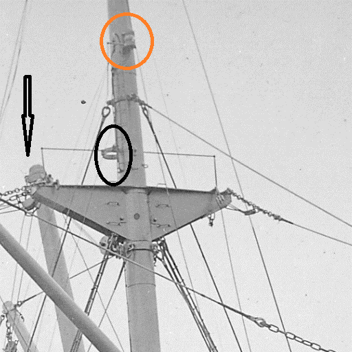
So what happened to the green light? was it extinguished? this would be highly unlikely because ships with electrically lit side lights and other navigation lights carried emergency oil lanterns at the ready on the bridge for such an eventuality and were kept filled and primed by the ships light trimmer. Was the green light obscured by the ships own smoke from its funnel I would say no for two reasons, the height of the funnel and the wind blowing from astern of the ship would blow it forward in a horizontal line well above the side lights. Secondly the regulations of that period 1909 state quite clearly that side lights must not be obscured by rigging, or equipment of the ship, or by the smoke and steam from the funnel. Captain Bruce could not make out if she was a large ship her lights (mast head lights) were in line with the centre line or stern of his ship. Ships usually cargo over 150ft in length or a larger passenger ship carried two white lights. The regulations specified that on the foremast a white light not less than 40ft above the deck must be displayed and be visible to other ships for a distance of 5miles. The after masthead light must be 15 feet above the foremast light and visible for 5miles, side lights had to be visible at a distance of 2 miles away.
 
                   The lower white light is the foremast white light, and the upper white light the aft mast light
After altering course out to sea with the Cape Hermes Light now astern of him, and if there had have been a ship on the coast behind him travelling north before he altered out,  her masthead lights would now been wide open and her starboard light visible  to the Harlow but there was no such mention of this. 
 

         If there had have been a ship he would have seen these lights behind him when he altered out to sea.
 
To be continued with an explanation as to why the lights suddenly disappeared from view of the officers of the ss Harlow.